Barr Trail to the Top of Pikes Peak
Hiking to the Summit of Pikes Peak
The Classic Barr Trail
The Barr Trail has the highest elevation gain of any trail in Colorado, so it is not for the weak of will. You gain 7400 vertical feet over 13 miles (one way).
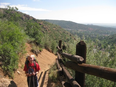
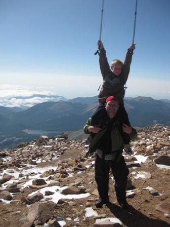
My son Mason and I hiked the Barr trail to Pikes Peak in 2009. He was 10 years old. The trailhead starts at 6720 feet. The beginning of the climb is brutal with over 3 miles of switchbacks. It can be hot and very tiring. You have a long way to go, so take it slow.
Drink lots of water.
It can be a lot colder up high, so be prepared with extra layers of clothes. It snowed on us in the first week of August. Thunderstorms are common. Be prepared for afternoon rain and watch out for lighting.
Here is the description from the Trails and Open Spaces Coalition:
The Barr Trail trailhead is in west Manitou Springs, off Ruxton Avenue, up Hydro Street near the Cog Railroad Depot. Finding an empty space at the lot during the summer season is difficult, so we suggest that you park at one of the City lots and walk up Ruxton Avenue.
View Barr Trail Trailhead in a larger map
The trail itself is a well-marked, packed dirt, rocks and decomposed gravel trail. However, it is not an easy hike. Four distinct segments of the trail exist, each with its own personality and challenges. The first section, consisting of switchbacks up Rocky Mountain, a subpeak of Mt. Manitou, are steep and very tiring, so take your time and stop to enjoy the view drink lots of water and rest a bit.
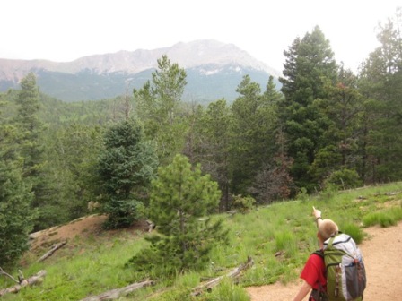
You will pass through beautiful forests of aspens, ponderosa pine and blue spruce. Wildflowers are abundant in July and early August.
At about 3 miles, you will cross Noname creek, where the trail levels out a bit. It’s a good spot to stop and have a snack.
The trail beyond Noname Creek to Barr Camp is the easiest part of the hike, with an elevation gain of 1,200 feet in approximately 4 miles. It goes through gently rolling aspen forests and meadows with spectacular rock formations and views of the Peak itself.
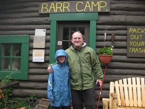
Barr Camp is approximately halfway up the mountain and is operated under permit from the Forest Service. It was built around 1921 by Fred Barr, the designer and builder of Barr Trail. It is located at 10,200 feet and provides overnight accommodations, some food (for a fee), and a place to rest. For further information on Barr Camp, visit their website. Donations are appreciated.
After you leave Barr Camp, the next three miles become steeper as you pass through forests of spruce and fir and then enter a region of very old dwarf trees. At treeline (about 3,000 feet below the summit), trees have disappeared and you are entering the tundra. It s easily damaged and takes years to repair itself, so stay on the trail.
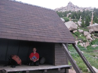
At tree line, you will see the A-Frame shelter on your left. You are now about 3 miles and two hours from the summit if you are a strong hiker. Allow more time if you aren’t acclimated.
The final miles to the summit are awe-inspiring. At about 1.1 miles from the summit, after a long trail traverse across the east face of the Peak, you will pass the Cirque on the left. It’s spectacular pit carved by the glaciers, with views of Lake Moraine and east.
The 16 Golden Stairs (there are really a lot more than 16) are a series of short, steep switchbacks in the final one-half mile to the summit. Climbing over rocks on a narrow trail, the altitude and unpredictable weather make this portion of the trail difficult.
source: Trails and Open Spaces Coalition
The summit is relatively flat and you can get some food or drink at the summit house (when it is open). People who ride the cog rail way or drive-up will be amazed that you hiked all the way up. Mason and I showed off with a great summit picture.
Find another great Colorado Springs Hike.